Honors 3900
Maps and journals used by Lewis and Clark
- Library of Congress "Before Lewis & Clark"
- Le Page du Pratz
- David Thompson
- PBS Empire of the Bay

Antoine-Simon Le Page du Pratz (1695?-1775), "A Map of Louisiana, with the course of the Mississippi, in The History of Louisiana, or of the western parts of Virginia and Carolina. London, 1763
 Aaron
Arrowsmith, "Map Exhibiting All the New Discoveries in the Interior
Parts of
North America," dated January 1, 1795
Aaron
Arrowsmith, "Map Exhibiting All the New Discoveries in the Interior
Parts of
North America," dated January 1, 1795
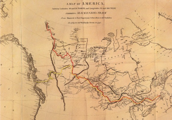 A
Map of America between 40 and 70 North, and Longitudes 45 and 180 West,
exhibiting Alexander Mackenzie's Track from Montreal to Fort Chipewyan
and from there to the North Sea in 1789 (red) and to the West Pacific
Ocean in 1793 (yellow)
A
Map of America between 40 and 70 North, and Longitudes 45 and 180 West,
exhibiting Alexander Mackenzie's Track from Montreal to Fort Chipewyan
and from there to the North Sea in 1789 (red) and to the West Pacific
Ocean in 1793 (yellow)
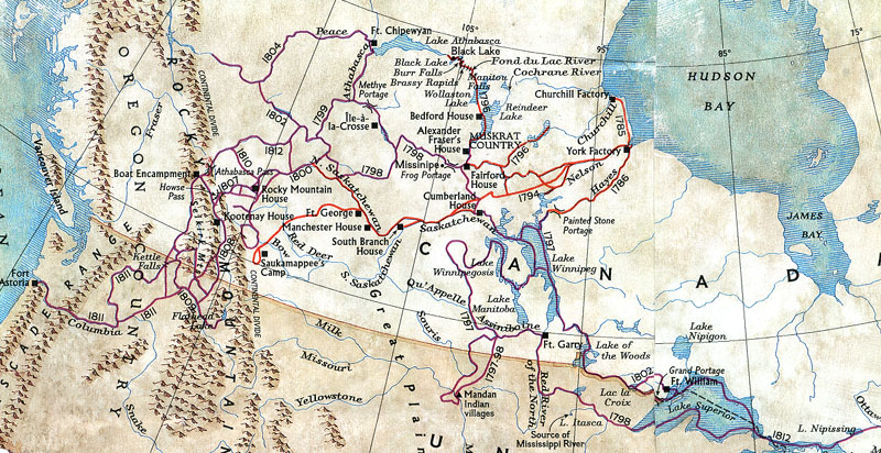
David
Thompson Map-National Geographic, May 1996 --From 1792 to 1812,
David Thompson mapped the country west of Hudson Bay and Lake Superior,
across the Rocky Mountains to the source of the Columbia River, and
followed the length of the Columbia to the Pacific Ocean.
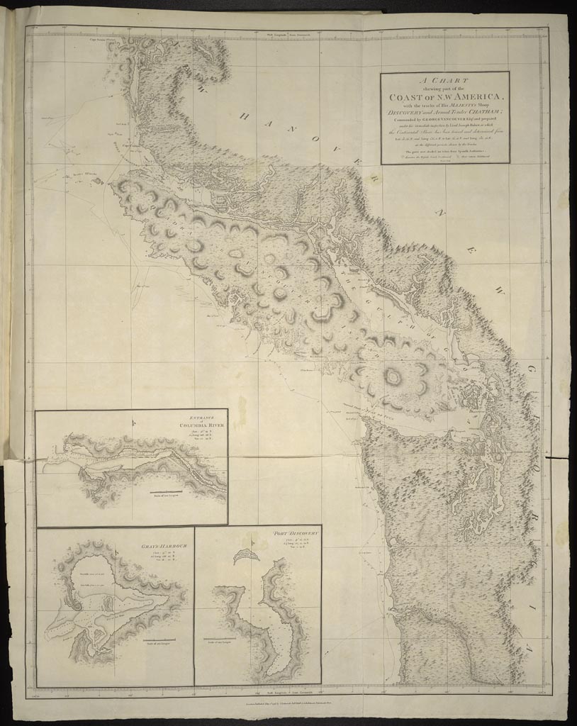 George
Vancouver (1758-1798),
"A Chart
Shewing Part of the Coast of N. W America . . ." from A Voyage of
Discovery to the North Pacific Ocean, and Round the World. London: 1798
George
Vancouver (1758-1798),
"A Chart
Shewing Part of the Coast of N. W America . . ." from A Voyage of
Discovery to the North Pacific Ocean, and Round the World. London: 1798
Samuel
Lewis (ca.1753-1822).
"Louisiana"
in Aaron Arrowsmith,
New and Elegant General Atlas,
Philadelphia: 1804.
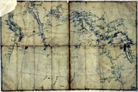 Nicholas
King map (ca. 1803) used by the Lewis and Clark expedition, with
annotations by Meriwether Lewis, showing their route along the
Mississippi and Missouri rivers
Nicholas
King map (ca. 1803) used by the Lewis and Clark expedition, with
annotations by Meriwether Lewis, showing their route along the
Mississippi and Missouri rivers