History 4120
The Federal Land Takings and Governance
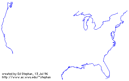
Boundaries of the United States and the Several States
(data source: United States Geological Survey Bulletin 1212 )
manmade boundary
disputed boundary
|
Controlling the West |
|||||||
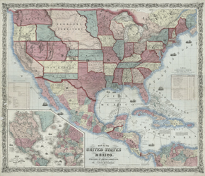 |
Johnson & Browning Map of the United States and Mexico New York, 1859 NYPL, Humanities and Social Sciences Library, Map Division |
||||||
|
|||||||
|
This mid-19th-century map displays settlement patterns still seen today: densely populated Eastern states contrast with the more sparsely populated West. But the nation is on the brink of war, and everywhere the map seems in motion. Wagon roads follow paths of least resistance, the river valleys, as do the railroad lines, both existing and planned. Sailing ships dot the oceans, symbolizing trade and worldwide access to goods and markets. The stagecoach mail route to San Francisco from the railheads near St. Louis and Memphis is boldly marked, suggesting that this map was designed for use in places of business or local post offices. The Butterfield Stage carried the mail across the southwest until the railroads were completed and took over express services. At the lower left, the international importance and weight of the United States is pointedly symbolized by its central placement on the world map, which emphasizes shipping routes to and from the Americas. |
Louisiana Purchase: 1803
Texas annexed (independent 1836-): 1845
Oregon Treaty: 1846
Treaty of Guadalupe Hidalgo: 1848
 "Map
of the United States of Mexico" used in the Treaty of Guadalupe Hidalgo
"Map
of the United States of Mexico" used in the Treaty of Guadalupe Hidalgo
![]() (See also:
http://www.loc.gov/rr/hispanic/ghtreaty/)
(See also:
http://www.loc.gov/rr/hispanic/ghtreaty/)
Alaska Purchase: 1867
Hawaii annexed: 1898
Readings:
Response paper #2: Explain the argument that the West is a distinct (and significant) region of the U.S. because of the presence of the federal government. Use readings to support your explanation.
Extra points paper (not due until end of semester): Visit a federally managed site in this area:
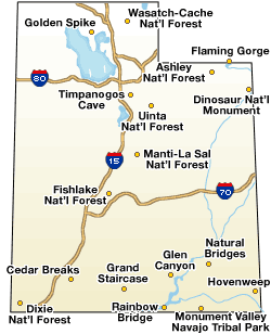
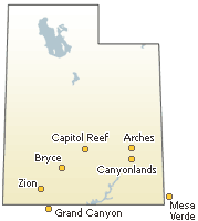
With five national parks, Utah is America's national parks capital. These national parks include: Zion National Park, Bryce Canyon, Arches National Park, Canyonlands National Park, and Capitol Reef National Park.
Utah also has seven National Monuments, two National Recreation Areas, a National Historic Site and six National Forests.
Visit the information center for that site, talk to knowledgeable personnel. Write a paper in which you summarize your observations and comment on the worthiness for the site to have national recognition and protection.