Colonial America By-the-Numbers
Below you will find an array of charts and graphs containing a wealth of information about life in colonial America. The statistics were generated by social historians working during the 1960s and 70s who focused on counting whatever they could to give a quantitative portrait of America. You'll notice the statistics may give a distorted sense of colonial America in that they focus much more on the relatively small population that lived in cities rather than the countryside where the vast majority of colonists lived. This disparity reflects trends in historical scholarship: the generation that was interested in quantitative history also tended to be more interested in urban history. (You'll also notice that the numbers are literally slanted. That would be from the scanner. My apologies.)
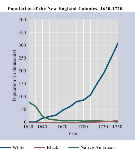
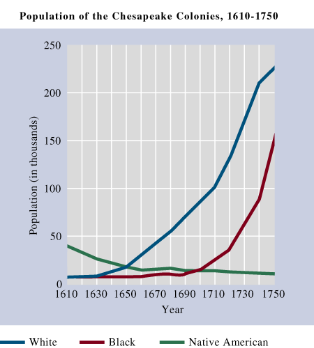
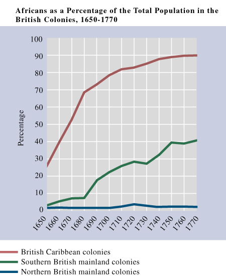
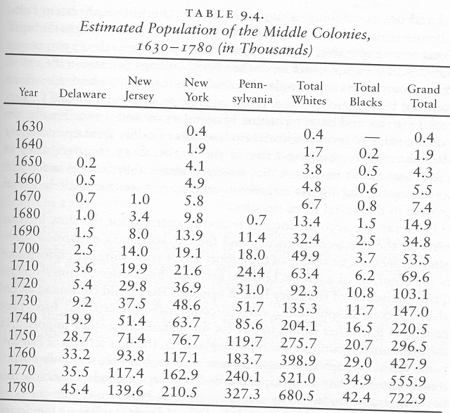
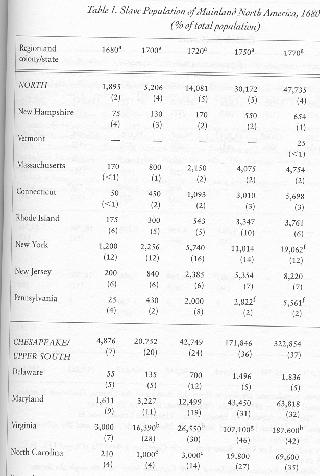
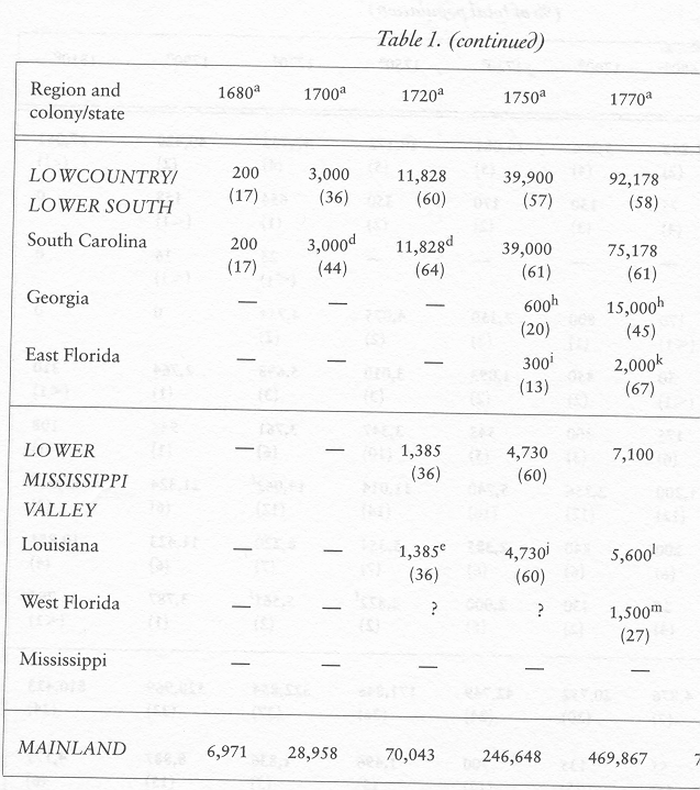
Population:
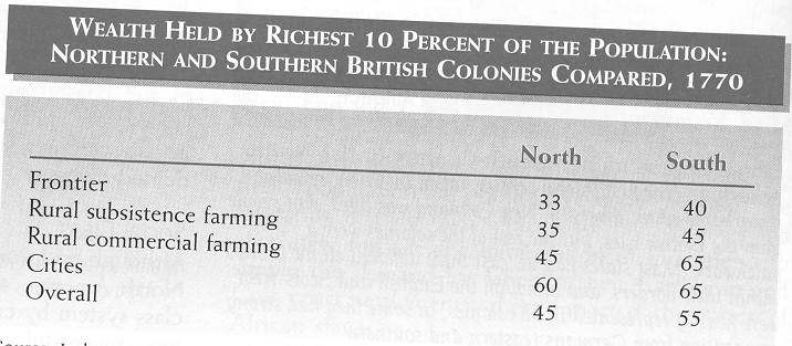
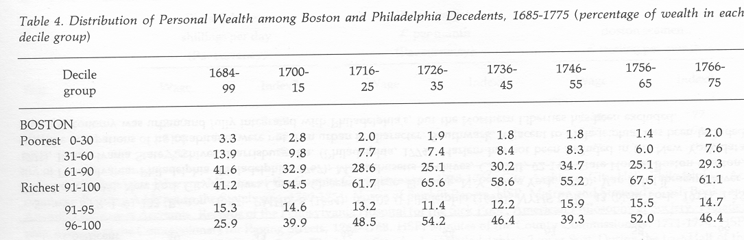
Wealth Distribution:
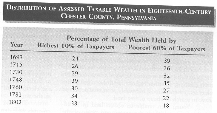
**NOTE: Chester County is in the Pennsylvania countryside, so this chart reflects rural rather than urban America
Colonial Cities:
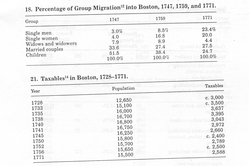
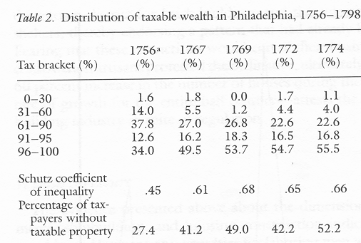
**NOTE: "Taxables" were essentially heads of households, which usually meant adult men. "Taxables" did not include wives (unless they were widows), children, dependents, servants, or slaves. Usually the poor were stricken from the lists of taxables because the property they owned was not considered to be worth enough to merit a tax.
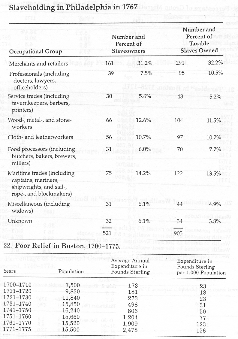
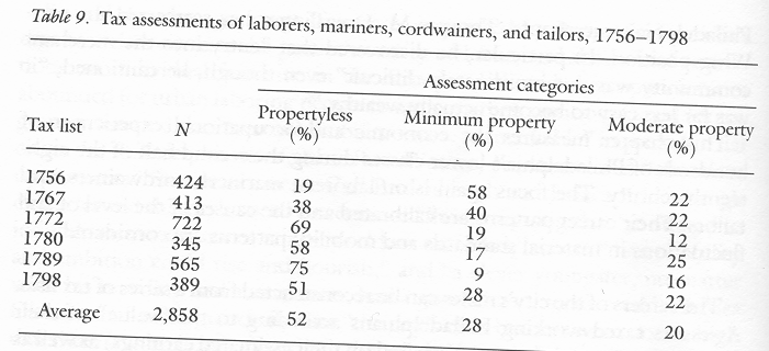
**NOTE: This last table charts the property held by Philadelphia laborers, sailors, and the poorest artisans (shoemakers and tailors). The categories measure those who had no property, those who held a little bit of taxable wealth, and those who possessed a moderate amount of property (which meant tools, livestock, or perhaps a home).
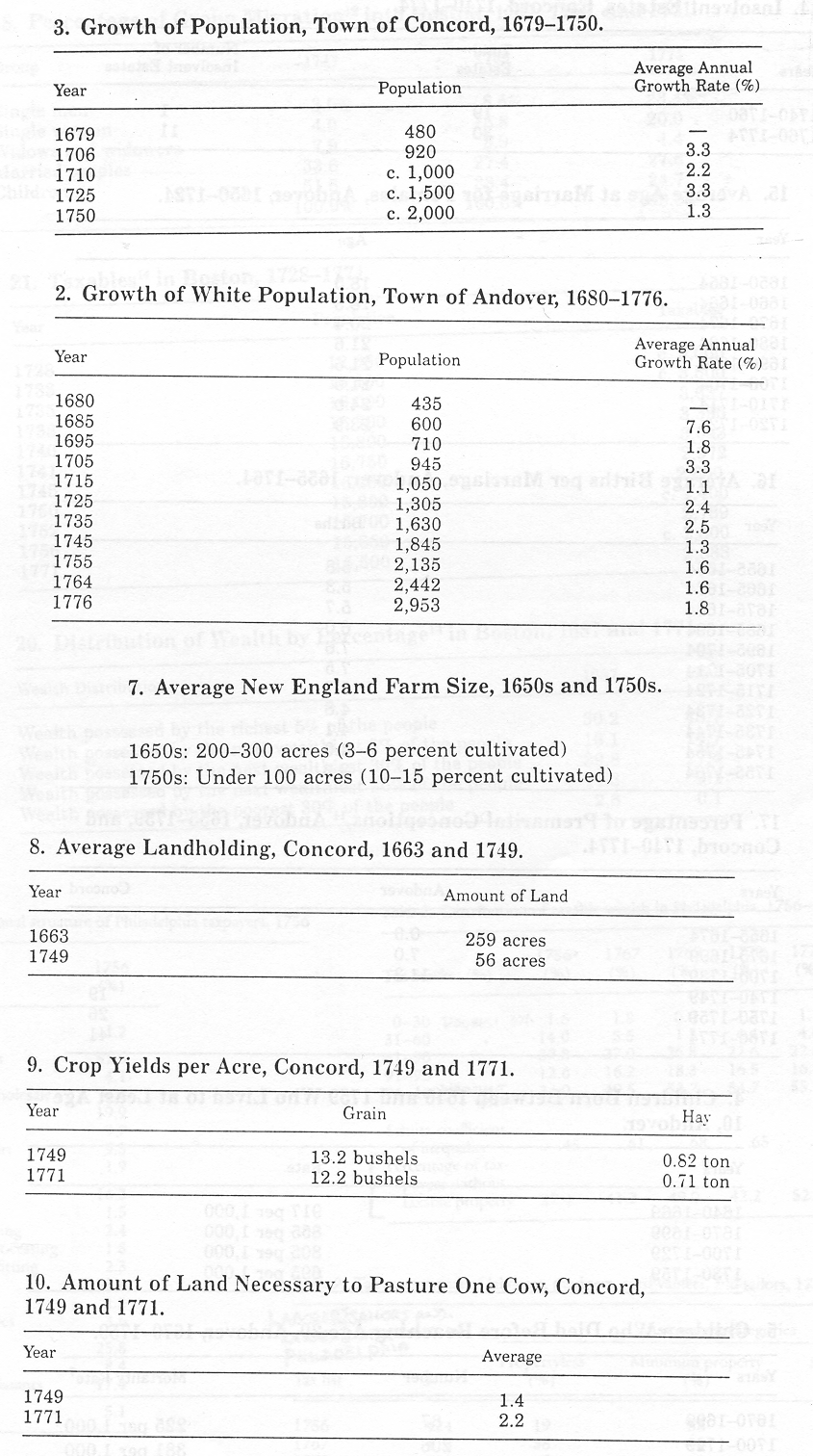
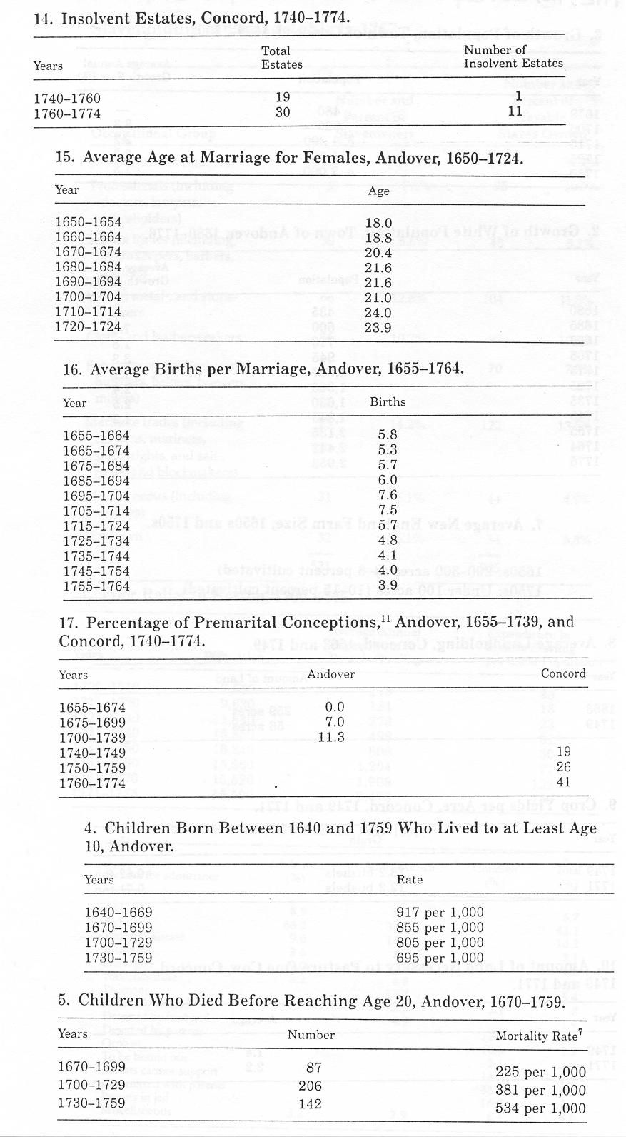
The Countryside and Rural Towns:
The following statistics were derived from studies on the Massachusetts towns of Concord and Andover.
Source:
http://www.research.umbc.edu/~bouton/History407/ColonialStats/ColonialStats.htm